Graeme Timmeney

GraemeTimmeney

Builds geospatial AI systems that map marine ecosystems at national scale, turning drone and satellite imagery into habitat maps and carbon inventories.

130,000 square kilometers of Bahamian waters. One national seagrass carbon inventory.

I designed the technical pipeline behind it for the Government of The Bahamas, from drone and satellite imagery to habitat maps, carbon stocks and uncertainty layers.

Work by Graeme Timmeney

Graeme Timmeney grinning up at the camera while a survey drone hovers in the blue sky above him.

Trained on Tumors, Deployed on Seagrass

Blue Carbon International. GIS and Remote Sensing Director since 2024.

Neural networks built for medical image segmentation work well on shallow seafloor. I adapt that computer vision to the seafloor as technical architect of a pipeline that runs from drone and satellite imagery to habitat maps, carbon stocks and uncertainty layers.

The goal is a national seagrass carbon baseline with uncertainty estimates, built to IPCC Tier 2 standards and suitable for Article 6.2 of the Paris Agreement.

Read the seagrass case study

cratemap.com
The CrateMap home page: the headline Map your crates, plan the set, above a yellow route map of tracks labelled with Camelot keys.

CrateMap

Co-founder and CTO. DJ performance intelligence.

CrateMap sits on top of DJ software, records sets as energy maps and learns harmonic transitions. I co-founded it with Chris Comisar and lead the engineering.

It soft launched in May 2026 and is in use by touring DJs.

Visit cratemap.com
The KiLO site on a phone: a halftone portrait dissolving into repeated KiLO lettering above the line The only way out is through.
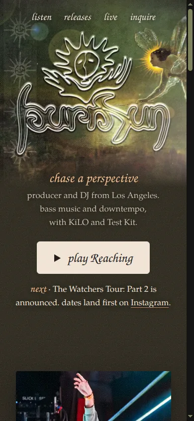
The burnsun site on a phone: a hand-drawn sun and chrome lettering over a painted green ground, with the line chase a perspective.

Websites and design

Two artist sites live now.

I design and build websites, pitch decks and presentations. KiLO lives at kiloselect.live and burnsun at burnsunmusic.com. Both lead with the artist's artwork and music, and both are built for the phone.

See the web design work

Visuals and VJ work

The maps keep going after hours. I render terrain and city models as motion and cut them into loops.

Mirrored terrain in ice blue
City skyline as a point cloud
Terrain model under violet light
City blocks traced in neon outline

Tour manager for Comisar

I manage tours for the producer and DJ Comisar: festival advancing, artist relations, travel, lodging, border logistics and day-of-show coordination.

Artists I support with sites, branding and promotion

Underlined names link to sites I designed and built.

From Montessori guide to systems engineer

I started as a Montessori guide and preschool teacher. That training still shapes how I build technical systems and how I explain them.

  1. Observe.
  2. Prepare.
  3. Build one piece at a time.

"Montessori-style assembly of methodological LEGO pieces."

How I describe the job

Every system I build goes together the way I once taught: one tested piece at a time.

Systems engineer and GIS architect

I assemble pipelines from the newest components I can find. I direct coding agents with specs and handoff documents, build company knowledge bases, and hire and manage a team of engineers, annotators and coordinators.

Geospatial AI
Semantic segmentation, model ensembles, pseudo-labeling, cross-resolution distillation, PyTorch.
Remote sensing
Atmospheric and water column correction, sunglint removal, pansharpening, drone photogrammetry, satellite-derived bathymetry.
Carbon and uncertainty
Spatial machine learning, error propagation, IPCC Tier 2 methods, accuracy assessment.
Data and cloud
GPU pipelines, DuckDB spatial, Cloud-Optimized GeoTIFF, GeoParquet, MLflow, Python, Rust.
AI-native engineering
Directing coding agents with specs and handoff documents. Company knowledge bases.
Operations
Field campaign planning, multi-vessel and drone operations, tour management, festival advancing, vendor coordination.
Teaching
Training design, public speaking, stakeholder briefings.
Design
Websites, pitch decks, slide design.

Speaking and press

Graeme Timmeney in an olive jacket and glasses, smiling on the deck of a boat with turquoise water behind him. Graeme Timmeney in a cap, standing in a field of red poppies at dusk.

About Graeme Timmeney

I am GIS and Remote Sensing Director at Blue Carbon International. I am based in the Denver area and work between Colorado and The Bahamas. I am from west Michigan, with strong ties to Kalamazoo and the Great Lakes.

I went to Kalamazoo College on the Heyl Scholarship, and finished my undergraduate degree at Western Michigan University. I also hold a master's in education from Portland State University and a master's in geography from Western Michigan University, where my research mapped the spatiotemporal distribution of Sargassum on Grand Cayman using satellite imagery.

I care about who owns and benefits from environmental data, ethical AI in Earth observation, and local communities doing the work that protects their own livelihoods. Off the clock I sail, hike and get outside with my dogs.

Sunset over calm water and a rocky, tree-lined shore.

Get in touch